

Over the past few days, a number of funnel clouds have been seen forming in skies over Devon and Cornwall.
Funnel clouds or ‘tuba’ are extending ‘finger like’ clouds which do not normally reach the ground. In the UK are are typically harmless, however in extreme weather hot spots, such as in the USA, they can become tornadoes or waterspouts if they hit a body of water.
The Kernow Weather Team explained: “There is usually an updraft within showers and thunderstorms, where warm air rises. If there is a change of wind speed or direction as the air rises (wind shear), this updraft begins to rotate.
“As the updraft rotates, it is stretched vertically, so the area of rotation shrinks and the spinning air speeds up. The old analogy is an ice skater twirling who pulls in her arms and starts to spin faster.


They don’t even need a thunderstorm to form, they can develop from the base of shower clouds or just cumulus clouds, but non-thunderstorm funnels rarely touch the ground.
“Funnel clouds are visible if there is enough moisture being sucked in by the rotating and stretched updraft, but sometimes these are not always visible if the air is very dry.
“Funnel clouds usually form when there is enough instability in the lower atmosphere to create convection or strong updrafts, i.e. the energy needed for cumulus clouds to rise and form shower clouds or thunderstorms if they become cumulonimbus clouds.
“When one of these cumulus or cumulonimbus clouds interacts with a breeze convergence zone, some of the rising updrafts into the cloud can start to rotate- thanks to opposing wind directions meeting at the surface. That rotation can develop in the form of a funnel cloud which is weakly rotating.”
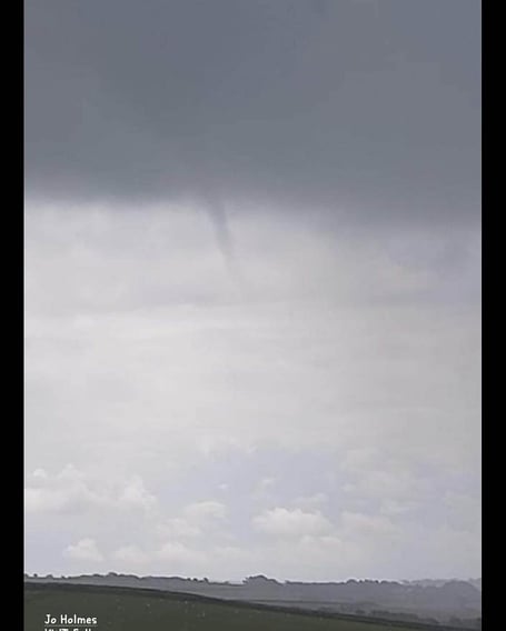
This video shows a funnel cloud forming over Valley Truckle in camelford, looking towards Bodmin.
(Video taken from Mike O'Carroll - all rights to Kernow Weather Team)
Comments
This article has no comments yet. Be the first to leave a comment.