What becomes of a former railway line when it is no longer used for the transport of passengers and goods?
The closure of multiple railway lines in the 1960s by British Railways after the Beeching Report of 1963 meant there was an abundance of unused land once travailed by steam and diesel locomotives.
Some, such as Southern Way in Wadebridge, or the aptly named Beeching Close in Halwill Junction, become housing estates, with little evidence of the railway which came before them.
Others, such as parts of the North Cornwall line that closed in 1966, became infilled and part of agricultural land.

Then there’s places like Berrycoombe Car Park in Bodmin, which was once the site of the Bodmin North railway terminus or Padstow Station, which while the former station building remains as the offices of Padstow Town Council, now serves as a large car park serving locals and holiday makers alike where once they’d arrive to their destination by train.
While many of the earlier closures of the railways, mostly lines which closed in the 1960s were redeveloped for other purposes with the only remains left being the odd abandoned tunnel, such as at Trelill, or the odd bridge to nowhere, such as at St Kew Highway, within a decade the post-railway landscape would be different.
Many station buildings, mostly now severed from the lines which once connected them themselves became repurposed, with some as private residences, such as at Camelford, Port Isaac, St Germans and Delabole, or community hubs, such as Wadebridge and Saltash.
The 1970s had seen the rise of the preservation movement, comprising groups of enthusiasts and volunteers seeking to preserve pieces of railway lines and the locomotives which once travelled along them. Some, were the same locomotives that they had recalled seeing in their youth, such as the steam trains at Bodmin and Wenford railway, or rebuilt as narrow gauge lines, such as the Launceston Steam Railway.
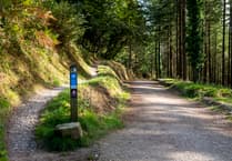
It was around this time that thought came to the idea that the left-behind railway lines actually made great public trails with the characteristics of being flat and relatively easy to surface proving appealing.
The Camel Trail, an approximately 12 mile former railway line from Bodmin to Padstow, via Wadebridge in addition to a branch from near Bodmin to Wenfordbridge, in some ways owes its existence to the fact that unlike many other lines, it remained in a railway form in parts until 1983 due to its requirement as a freight line for clay from Wenfordbridge to Bodmin General.
This made it ideal to transform into the multi-use trails we enjoy today. But unlike some places, where the remnants of the railway which came before it were condemned to the scrapheap, the Camel Trail offers several clues to the history of its former life.
We’ll start our journey where the railway began in 1834; that car park on Berrycoombe Road which was once a railway station known as Bodmin North.
While the Bodmin and Wadebridge railway opened on July 4, 1834, Bodmin North wasn’t the place the trains originally stopped at and originally, the trains from Wadebridge stopped at a temporary terminus at Dunmere (close to where Dunmere Halt was) as the station was not ready to open, which it eventually was on September 30, 1834.
At one point, the station featured a cattle dock in addition to its passenger platforms and there was also a private siding at the gas works, land now occupied by the Bodmin Community Fire Station.
The Platforms
Perhaps the biggest clue that the Camel Trail once had a life as a railway is the fact that the early 1900s platforms between Bodmin and Wadebridge still remain in-situ.
These days, they’ve got large replica Southern railway era signage to remind the visitor where they once were. Prior to 1906, the entire line had been a continuous line between Bodmin and Wadebridge with no official intermediate stops in between. However, with the London and South Western Railway planning to introduce an early version of what we would now call metro-style lines, simple platforms were built along the route with the intention of providing a connection point for residents of the hamlets and villages between the two towns.
Dunmere Halt: Dunmere Halt is the first station you come across on the way to Wadebridge from Bodmin and like Grogley and Nanstallon, it opened on July 2, 1906 as part of the aforementioned railmotor service between Bodmin North and Wadebridge.
While the look of the platform originally is of a conjecture lost in the mists of time, by the time the platform closed in 1967, it had featured a Great Western Railway ‘pagoda’ style wooden shelter, which was removed when the line was closed.
Direct access to the platform, like now was not the most accessibility friendly, with access provided by a short foot path down a slope by the road bridge which carries the A389 to Wadebridge.
At its peak, Dunmere saw 14 trains a day, reducing to eight by 1938 and after the introduction of the Boscarne Exchange Platform and the shuttle service from Bodmin North to that point, the service reduced further to five a day.
Boscarne: A short distance after Dunmere Halt is Boscarne upon arrival, you are quickly greeted by a delightful looking platform with replica era-signage and logos. However, this is a replica platform built by Bodmin and Wenford Railway, opening in 1996.
Prior to the Bodmin and Wenford’s arrival in 1996, Boscarne had its own platform for just three years of its existence, and to call it a platform is certainly stretching the word to its limit.
Boscarne Exchange Platform, as it was known was a very basic wooden platform opened in 1964 whose only facility was an oil lamp and which had no public access, solely serving as a crossing point for people wishing to join the now-truncated service from Bodmin North to Dunmere to join the service from Bodmin General to Wadebridge. On the Bodmin General to Wadebridge end was a small platform, on the Bodmin North end was….the ground beneath your feet.
Nothing remains of the exchange platform now, and where it was located was slightly further up from the Boscarne Junction station of Bodmin and Wenford Railway as it heads from Boscarne, next to where the line-side foliage begins.
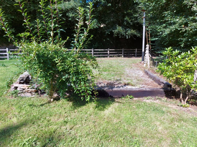
Nanstallon Halt: Not a lot exists of Nanstallon Halt as it once was today, with a house and a rather overgrown bush covering a good amount of where the platform once was, although like elsewhere, a large replica sign helpfully assists you with your bearings.
Once upon a time, Nanstallon Halt also played home to a single siding (or a wharf as it was sometimes referred to) that at some point during its history would have included a goods shed.
Until around the 1950s, the platform at Nanstallon was of a rudimentary wooden construction and had no shelter, before being rebuilt out of concrete with a pagoda style shelter similar to Dunmere also provided at some point during the platforms history, lasting until the 1960s.
Aside from the barely accessible platform and sign, all that remains of Nanstallon Halt now is an old station building which now serves as a private garden shed.
Grogley Halt: A station so rural it was only ever served in daylight. Grogley Halt’s location owes itself to the fact it was at this point that the junction to access the mineral line to Ruthernbridge was built (closing in 1933) rather than any nascent demand from the masses of local residents, of which there were not many.
Like at Nanstallon, originally, the platform was built out of wood, although it is known that a pagoda shelter was provided here before 1933, later replaced by a simple wooden shelter when the platform was rebuilt in concrete after World War II.
Shooting Range Platform: Shooting Range is not so much a platform as it is a muddy bank, and that’s because it wasn’t ever really a railway station and certainly never had a sign saying where it was!
The story of Shooting Range Platform is that in around the time of 1880 to 1885, it was built solely to serve a military firing range nearby and for this reason, trains would only ever stop with written permission from the Army. Use of the rifle range located there was intermittent, mostly concentrated around the times of Boer War and World War I, with rail the only way it was possible to access it.
The range itself ceased use shortly after World War I, but the platform with a surface made of cinder was used until 1947.
Part 2: The Architecture the Railway Left Behind’ coming soon.
Comments
This article has no comments yet. Be the first to leave a comment.